Check Out Top 10 Best Treks in Western Ghats You Should Have Your Eyes On Post COVID!
During lockdown and COVID crises we all realized that staying for months together between 4 walls is tough and after a point, it starts getting to our mind. Ever wondered why the saying goes “out of the box” thinking/action as our creativity gets invoked when we think or do different things. Mainly it breaks the regular pattern!
As per health experts, Nature and Adventure are one of the major influencers in the positive transformation of one’s life. Thus, the trek becomes the best way to experience the majestic mountain, thrilling escapade from the same routine and a viable source to push our boundaries. We truly hope that this crisis gets resolved soon so that we can again explore the scenic beauty and the magic of mountains.
We have a list of 10 best treks in the world’s renowned mountain range – Western Ghats. It is even older than the mighty Himalayas and recognized as one of the world’s eight ‘hottest hotspots’ of biological diversity. Starting from Gujarat until the southern tip of Kerala, it covers an area of 1,40,000 sq km.
[lwptoc]| Treks | Nearest to which City | Difficulty Level & Trek Distance | Best Time to Visit |
|---|---|---|---|
| Kalsubai Trek | Mumbai / Nashik (Maharashtra) | Moderate to Tough 6.6 km long trek (One way) |
July to September (Monsoon) |
| Chembra Peak | Kozhikode (Kerala) | Moderate Approx 10 kms long trek (to & fro) |
October to February (Winter) |
| Kodachadri Trek | Kollur / Kundapura (Karnataka) | Moderate Around 12 kms long trek (One way) |
September to January |
| Harihar Fort Trek | Nashik / Mumbai (Maharashtra) | Easy to Moderate Approx 10 kms long trek (to & fro) |
November to February (Winter) |
| Uttari Betta Trek | Bangalore (Karnataka) | Easy Approx 7 kms long trek (to & fro) |
July to February |
| Mullayangiri Trek | Chikmagalur / Kadur (Karnataka) |
Easy to Moderate Approx 10 kms long trek (to & fro) |
September to April |
| Rajmachi Trek | Lonavala / Mumbai (Maharashtra) | Moderate Approx 15 kms long trek (to & fro) |
July to September |
| Kudremukh Trek | Sringeri / Mangalore (Karnataka) |
Moderate to Difficult Approx 22 kms long trek (to & fro) |
October to February |
| Anamudi Trek | Munnar (Kerala) |
Moderate to difficult Approx 17kms |
November to February |
| Kalavantin Durg – Prabalmachi Trek | Panvel / Mumbai (Maharashtra) |
Moderate | July to February |
Kalsubai trek – The Everest of Maharashtra
Nestled in the Kalsubai Harishchandragad Wildlife Sanctuary and often called the ‘Everest of Maharashtra’. This peak is situated at an elevation of 1646 meters (5400 ft). The entire landscape of this mountain is surrounded by paddy fields, lush greenery, steep route, rich flora, and fauna. This makes it the first choice for passionate trekkers.
Ways to reach:
By Air – Mumbai Airport is the most accessible which is around 160 km (4 hrs drive).
By Train – From CST or Dadar railway station (Mumbai) you can take a local train to Kasara Railway Station (2 hrs journey). From Kasara, there are multiple options of bus, tempo, or rickshaw to travel by road to Bari Village (1.5 hrs journey).
Local train and Kasara links are the best affordable and time-saving way to reach or else one can also directly drive down to Bari Village from Mumbai / Pune / Nashik.
The trek which starts from Bari village has steep slopes, sharp stone outcrops, and an exhausting route which makes it ‘moderate’ difficulty level for trekkers.
The best part is to catch the sunrise as well as the mesmerizing views of nearby hills after reaching on top of the peak. You will also find the Kalsubai temple there on the top. Have your packed meal and get ready to sense the adrenaline rush while descending the mountain. It is a safe trek as the government has installed iron railings, concrete steps with metal landings along the route.
The best time to trek is during Monsoon (June – September) as you will experience nature’s delight – exotic forest, fresh air (rare for urbanites!), waterfalls, mist, river streams, and even rainbows if you are lucky.
We highly recommend Kalsubai for an amazing trekking experience and it will surely be in your memories forever!
Chembra Peak – The Pride of Wayanad
For all those who love trekking, Chembra is one of the highest peaks in southern India which is around 2100 meters in altitude. Trekking at this place is best known for the greenery around the peak which is richly filled with tea & coffee plantations and authentic herbs of the region. Another jewel of Chembra is its heart-shaped lake which will be a highlight in your Insta pictures. The lake view and cool breeze have the best soothing effects.
Ways to reach:
By Air – If you are flying in, the nearest airport is the Calicut International Airport which is 92 km away.
By Train – The nearest railway station is Kozhikode which is 79 km away.
By Road – From Kozhikode, there are several buses by both government and private operators that can take you to Kalpetta which is about 13 km. From here you will need to take another bus which takes you to Meppadi which is 7 km from the base. Also, one can take their own vehicle and reach the base village.
Trekking at this place needs the approval of the forest administration and it’s only a day trek as night stays are riskier because of the wild animals.
There are numerous peaks around this highest peak but trekking those are difficult and dangerous due to dense thick coverage of forests.
It’s one of the best scenic places and a destination spot for trekking clubs.
Chembra Peak is worth visiting all year round but isn’t suggestible during the monsoon months of June and July.
Kodachadri Trek – Thrilling to its core
The Kodachadri trek is for the ones who love adventures while trekking. A little more extra care is needed if you and your gang have decided to trek this mountain. Having said that, it’s one of the highest peaks in Karnataka and famous for the dense jungle surrounding the peak.
This peak is dry and deserted which makes it hard to spot from the ground. The trekking peak has this beautiful reddish-brown color due to the presence of iron ores in its soil.
As you trek and climb above sea level, you witness tremendous views and species of flora and fauna as this trek is also located in one of the National Parks.
Ways to reach:
By Air – Mangalore International Airport is the nearest airport, which is about 153 km away.
By Train – Shimoga and Kundapura are the nearest towns to reach Kodachadri. If you reach the nearest railway station, vehicles are available there as well and the road passes through the Nittur village.
By Road – From Kollur, by road and hire vehicles is the best way to reach the spot. It is around 40 km away.
There are basically two options to reach the top of the peak. You can either trek or you can rent a vehicle to reach halfway and trek the other half. If you are planning a whole trek from the ground level, then you can witness the Hidlumane Falls, Shankara Peetham, Ganapati Cave, the Sunset Point, and Chitramoola which has to be done under the supervision of the guide. If you are planning to camp, then permission is required from the forest admins.
Climbing down is more dangerous than the other way around in Kodachadri. With great care, patience, and guidance, one can achieve adrenaline rush through this trek.
The best time to trek is in January. To witness both the barren and greenery at one place, Kodachadri is indeed the best choice.
Harihar Fort Trek
This fort was built by the Yadava dynasty to protect the ancient trade route and acted as a watchtower. It is situated in the Nashik district. The most famous and trickiest part in this trek is climbing the 80-degree steep stairs which seems like a stone ladder on the slope of the 60-meter pinnacle.
Ways to reach:
By Air – Nearest is Mumbai Airport which is around 190 kms (5 hrs drive).
By Train – There are 2 options, either reaching Nashik railway station or driving down to the base village – Nirgudpada (60 km away). Another alternative is from Mumbai and similar to Kalsubai trek wherein from Kasara Railway Station, board rickshaw/van/tempo/bus to reach Igatpuri (20 km away) and from there to Nirgudpada by bus/rickshaw/tempo, etc which will be 50 km away.
By Road – From Nashik city it takes around 1.5 hours to reach base village Nirgudpada and from Mumbai it takes 5 hrs drive. There is another base village Harshewadi which is comparatively closer to the fort. When coming in groups it is advisable to start from Harshewadi instead of Nirgudpada.
You will be surprised to see the ruins of this fort and imagine how the soldiers must be patrolling it during day and night. With history, you also get Nature’s bounty and adventure (especially while climbing the pinnacle). During monsoon, the trek becomes risky as while climbing if you slip, you can endanger your life as well as the ones behind you because of the 80-degree ascent. So advisable to keep a safe distance and climb slowly.
The best time to visit will be during the winter (November to February) as otherwise summer is unbearable and monsoon is risky. Also during winter months, you can spot greenery and abundance of scenic sights.
Uttari Betta Trek – Majestic Hill Fort
It is also known as Huthri Durga (fortified hills) and closer to Bangalore. This hill fort was built by Kempagowda (Chieftain under Vijayanagara Empire) in the 16th century. There are two small hills surrounding the village through which ruined defensive walls of the iconic fort are still visible.
Ways to reach:
By Air – Nearest is Bangalore Airport which is around 90 kms (2 hrs drive).
By Train – Bangalore Yesvantpur Junction is the most accessible and nearest railway station from the base village (60 km away).
By Road – From Bangalore city a 70 km drive. There are KSRTC buses, private vehicle options, cabs, etc.
It is a one-day trek for the People who want to take a break and enjoy a glimpse of nature. This is a 5 km easy trek across a breath-taking lush green landscape that offers scenic views. Crossing a small jungle-cave, with some wildlife which includes different types of insects, birds, and mammals, including bear, leopard, and wild boar, this trekking trail will be one of the best ever experiences.
The hillfort has eight gateways from the foot to the summit in addition to seven outer gates. The trek starts from a small village, entering the fort wall and passes through eight doors of stone to reach the halfway point of the hike which has a temple of Shankareswar at the top.
The best time to visit this place is between August to February.
Mullayangiri Trek – Tallest peak of Karnataka
It is one of the most scenic and popular places with fantastic views in South India. This place is famous as the highest peak point with a height of 1,930 meters (6,330 ft) in Karnataka. Similar to Kudremukh, this peak lies in the Chikmagalur taluk and hence is surrounded by forests and national parks.
Ways to reach:
By Air – Mangalore Airport is nearest and which is 135 km away (3.5 hrs drive) and from Bangalore Airport it is 290 km away (6 hrs drive).
By Train – Nearest Railway station to this place is Kadur Junction (60 km away) and even Chikmagalur railway station (25 km away) but very few trains stop here.
By Road – People looking to plan their Mullayanagiri Trek from Bangalore which is 275 km (5 hrs drive) can opt to take a bus to Chikmagalur. You can also opt to drive yourself wherein we suggest bike ride over the car to enjoy the windy climate and serpentine route. The nearest and accessible place in Chikmagalur which is around 25kms (50 mins drive).
Generally, the trek starts from Sarpadari. The trail passes through the windy and zigzag forest with a cool breeze. People can see the beautiful Western Ghats once you reach the top of the peak.
It takes 2 days to cover the places near Mullyanagiri. Once people complete the trek people can visit Baba Budangiri hills (around extra 12 km of trekking) which are 33 km from Mullayanagiri, Hirekolale Lake which is 15 km away, and also you can visit Jhari or Dabdabe falls which is 22kms from Chikmagalur (a popular hill station in Karnataka).
The best time to visit this place is from September to April (winter months).
Rajmachi Fort – Lonavala’s forest paradise
This place is another heavenly paradise for the travelers . It consists of two twin fortresses – Shriwardhan Balekilla and Manaranjan Balekilla (fortress in marathi language) with a height of 2,710 feet above sea level. Trekking at this place which is famous for its ancient remains and strategic location. ‘Machi’ means plateau. Also, it is a complete nature’s package where you will experience mountains, waterfalls, green valleys, beautiful forts, most amazing thrilling trails & many more attractions.
Ways to reach:
By Air – One can Reach Chhatrapati Shivaji International Airport which is the nearest airport to reach the Rajmachi Fort. From the airport, many private taxis and cabs and buses are available to reach directly to the Rajmachi fort.
By Train – Lonavala railway station which is well connected to most of the cities and Lonavala to Rajmachi Fort is around 16 km away.
By Road – If one is opting to take a bus there are many private bus operators who take you to Lonavala. Also, one can reach this place by their own vehicle. This place is situated just about 95 km from Mumbai and 80 km from Pune.
This Rajmachi Fort Trek is considered as a medium level trek. There are two ways to reach Rajmachi, one is through Tungarli (Lonavala) and the other way is through Kondivide village (Karjat route) which might be tricky and difficult at times. So, the most preferable route is from Lonavala as it is much easy and provides the best of the views.
Once completing the trek people can relax in the famous hill stations – Lonavala and Khandala. It is worth visiting Karnala Bird Sanctuary, Ekvira Temple, Karla Caves, Lohagad Fort (another fort in the vicinity), and Matheran Hill Station.
The best time to visit Rajmachi is in between July to September (Monsoon).
Kudremukh – A Breath-taking Forest Trail
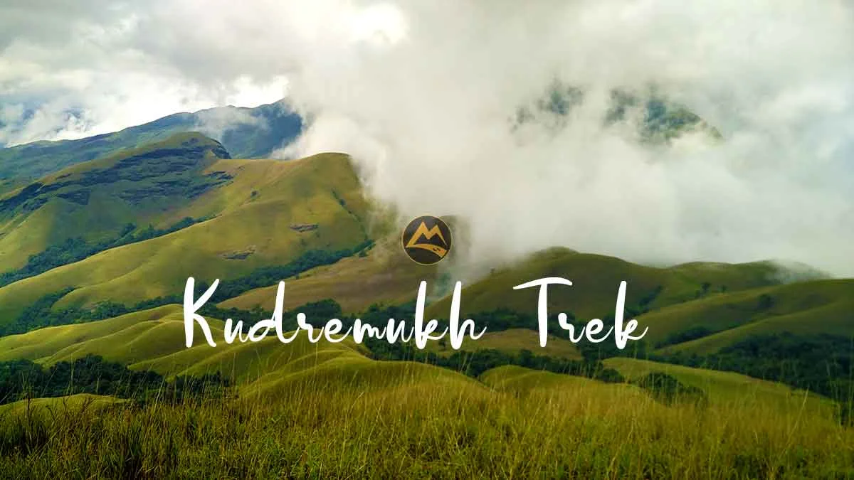
It is one of the top destinations near Chikmagalur which offers a paradise for trekkers. It has beautiful hills and is the second-highest range (6,214 ft) in Karnataka. “Kudremukh” name means the “horse face”(Kannada) which is derived from the shape of the hill. It is a wet evergreen forest filled with waterfalls, mountains, and bamboo shrubs. Also, one of the largest forest reserves in Karnataka.
Ways to reach:
By Air – Nearest Airport to this place is Mangalore Airport which is 120 km away (3 hrs drive)
By Train – Nearest Railway station to this place is Udipi railway station (105 km away) and even Mangalore Junction (115 km away).
By Road – It is around 115 km away from Mangalore and we can reach there by bus, taxi, or by own vehicle. The government runs the KSRTC buses between Bengaluru to Hornadu, which stops at Kalasa and from there a van/vehicle to reach the forest check post of Kudremukh. One can even visit from Sringeri which is a popular temple town (around 60 km).
It takes one full day to trek to the top of the Kudremukh peak. Once you start the trek there is also an opportunity to witness attractive waterfalls as you pass on. Generally, the trek starts from Kalasa village and after completing the trek one can visit Hanuman Gundi waterfall, national park museum, Hebbe falls, Kallahati falls, Z point, etc.
The best time to visit Kudremukh is from October to February.
Anamudi trek – The highest peak of Western Ghats
Located near Eravikulam National Park in Munnar, Kerala (God’s own country). This peak is said to be the highest peak in the Western Ghats and entire South India with a height of 8,842 ft. The interesting fact about the meaning of the peak is often referred to as “Elephant’s forehead” which refers to the shape of the mountain.
Ways to reach:
By Air – The nearest airport to this place is Cochin International airport which is 114 km away
By Train – The nearest railway station to this place is the Coimbatore railway station which is 150 km, and the other stations are Ernakulam which is 120 km, and Madurai which is 170 km away.
By Road – If one is opting to take a bus, they can reach Munnar bus stop and can start the trek which is 17 km away from the peak. One can also take their own vehicle to experience breath-taking views.
Trekking at this place is said to be the best for the thrill-seekers, nature enthusiasts and photographers. This place is famous for the Neelakurinji flower, which is said to bloom for every twelve years and also known for many different tree species like bamboo, black wood, and teak trees. Different wildlife including Asian Elephants, Nilgiri Tahrs, Gaurs, etc. While trekking one can experience rivers flowing through the valley.
This trek is said to be a bit tough, but it’s not mandatory to have experience if you have the will to trek.
Other attractions near Anamudi are Munnar hill station, Tata tea museum, Mattupetty dam, Attukad waterfall, and Kundala lake
The best time to visit this place is between the months of November to February.
Kalavantin Durg and Prabalgad Trek – Twin source of Adrenaline Rush
A pinnacle which can give you a thrill of extreme adventure sports is Kalavantin Durg (2,250 ft). The serpentine stone pathways (without any railings) through which the clouds travel and literally the feeling is to climb the stairway to heaven!
Kalavantin Durg, Prabalgad and the Prabalmachi (Plateau) together used to host so many trekkers and nature enthusiasts pre COVID. As you can climb these pinnacle, nearby mountains as well as camp on the plateau. Camping provides an opportunity to try local Maharashtrian food prepared by the villagers who stay in the vicinity.
Ways to reach:
By Air – Nearest airport is Mumbai and it is approx 60 km away (1.5 hrs drive).
By Train – Panvel Railway station is the most accessible as it is well connected to Mumbai’s local train network and even with the outstation trains.
By Road – From Panvel it takes around 15 km (40 mins drive). There are multiple options to reach the base village – Thakurwadi by State transport buses, rickshaws, vans, or private vehicles from Panvel / Mumbai or Pune.
If you have 2 days, then it is possible to cover both Prabalgad and Kalavantin Durg for night stay there are homestays in the village. It will also be a unique experience to live the villager’s life and enjoy their culture. During monsoon, it is very risky to climb the pinnacle as no railing support and one mistake can also be fatal. During winters, people also come to Prabalgad for a night trek to enjoy stargazing.
Best time to visit is from July to February (Both monsoon and winter).
We hope that this overview of the amazing treks will help you achieve wanderlust. Hoping that the COVID situation normalizes soon for us to begin our journey in the mountains.
Check the travel guidelines during COVID times here!
Dandeli Tour Packages, Munnar Tour Packages, Gokarna Murudeshwar Honnavar Tour, Kodiakanal Tour Packages , Kotagiri and Conoor Tour Packages, Coorg Tour Packages, Ooty Tour packages, Wayand Tour Packages, Chikmagalur 2 days tour packages, Agumbe Tour Packages, Malvan Scuba Diving, Coorg Long Weekend Tour Packages, Mulki Kayaking Packages.
Sikkim Tour Packages(6D/5N), Nagaland Tour Packages with Dzukou Valley, Meghalaya Tour Packages(No Trekking), Hornbill Festival Tour With Dzukou Trek- Nagaland (6D/5N), Nagaland Backpacking Trip With Dzukou Valley Trek (6D/5N), Meghalaya Backpacking Trip(6D/5N), Tawang Backpacking Trip (7D/6N), Sikkim Backpacking Trip (6D/5N), Tawang Private Trip, Kaziranga National Park Safari (2D/2N),
